SNOW HOLIDAY
ENQUIRY
The Grasshopper – The Latest Snow Forecast

The Grasshopper – The Latest Snow Forecast

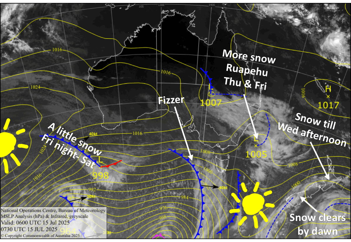
Australian Forecast – Great Underfoot, But Damp Conditions and Flurries Persist

Published early Wednesday, 16th July 2025

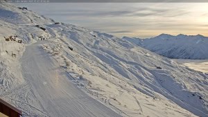
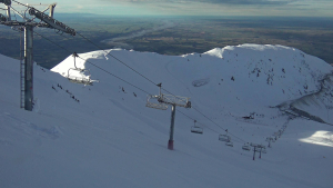
Aussie resorts scored an extra 8-12cms Sunday night on top of 25-57cms from the storm earlier last week, while the snow guns have also had a good run. So, despite continued cloud and flurries, we’ve had great conditions underfoot the last couple of days.

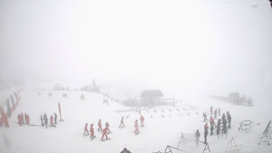
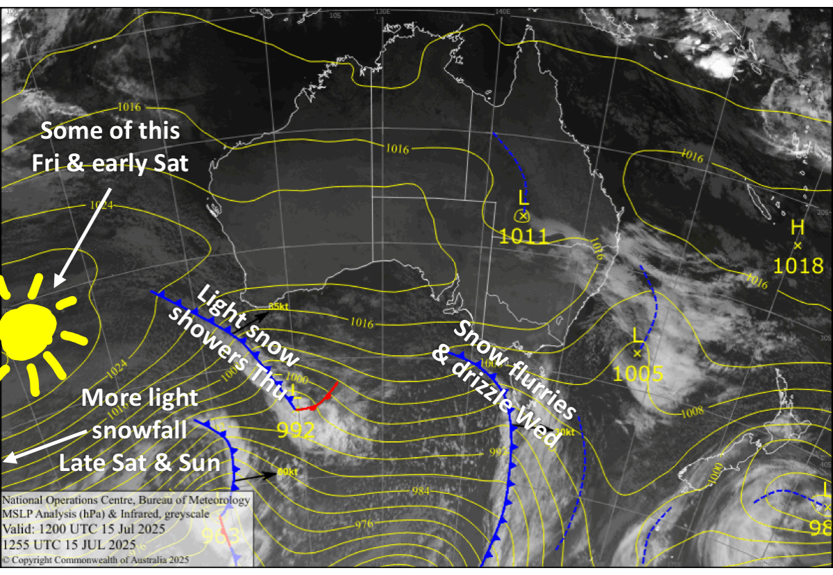
Cloudy, clagged-in conditions will persist through Wednesday and Thursday, particularly for Victorian resorts,  as a couple of weak fronts brush the Aussie Alps, with light snow showers and flurries adding a little extra to mid and upper slopes. However, damp conditions will soften things up on the lower slopes.

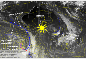
A ridge of high pressure will finally clear things up for a nice day on Friday. But another weak front brings more light snowfall and cloud late Saturday into Sunday.


Latest pressure analysis and satellite image. Source: The BOM (vandalised by the Grasshopper)

Wednesday 16th July

Low-level cloud and patchy drizzle/flurries will keep Victorian resorts clagged-in with low visibility for the day. Some of this cloud will also affect New South Wales, but it should be a bit brighter there. Brisk west to northwest winds.

Thursday 17th July

Cloudy and clagged-in again, with snow showers and flurries above 1400-1500m, mostly in Victoria, where up to 5cm could accumulate, but damp conditions lower down. Just a skiff of snow is expected in New South Wales. Skies will clear up at night as brisk northwesterlies swing around to a light southwest.

Friday 18th July

A nice, sunny day with light winds and good snow-making conditions before opening time.

Saturday 19th July

A fine start, but clouds will increase as northwest winds strengthen, especially over Victoria, where light snowfall will turn up late in the day. New South Wales will be much brighter, and light snowfall will also turn up overnight.

Sunday 20th July

Cloud and light snowfall eventually clears for a fine end to the day, while northwest winds ease and turn westerly.
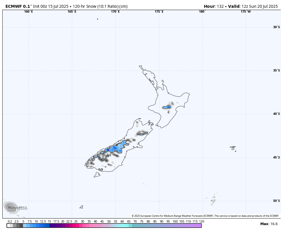
Extended Forecast

Forecasts for next week have really been chopping and changing. Currently, a front is expected to bring a mix of rain and snow between Tuesday, July 22nd, and Thursday, July 24th. We could then see more snow over the following weekend, the 26th and 27th of July, and/or early the following week, but we’ll have to wait closer to the time before making any big calls.

That’s all from me today, folks. I’m sending out these forecasts every Monday, Wednesday and Friday throughout the season. Have a great couple of days, and I’ll see you back here on Friday.

Grasshopper

New Zealand Forecast – More Snow, Especially for Mt Ruapehu, as Temperatures Dip


Published early Wednesday, 16th July 2025

After fairly mild temperatures and often wet conditions over the past few weeks, colder air is finally turning up in New Zealand. There’s been fresh snow in the Southern Lakes overnight (Tuesday night), which arrived much later than earlier forecasts had expected, as well as on Mt Ruapehu, where it is desperately needed.

Snow will continue to fall on Mt Ruapehu until Wednesday afternoon, and there’ll be even more on Thursday and Friday as a low-pressure system rolls over the North Island. Ski fields here could receive between 20 and 50 cms on mid and upper slopes, with a bit less on the lower slopes.

A weak cold front will likely give the Southern Lakes a dusting of snow Friday night, then a 5-10cm shot of powder to Canterbury ski fields on Saturday, before giving Mt Ruapehu an extra dusting Saturday night. The front will bring a nice and cold airmass, which will allow extensive snowmaking throughout the weekend.


Latest pressure analysis and satellite image. Source: The BOM (vandalised by the Grasshopper)

Wednesday 16th July

Skies will brighten over the Southern Lakes as the cloud cover gradually breaks up. Canterbury will also see some blue sky between cloud cover early and late in the day. Southwest winds over South Island ski fields gradually turn northwest.

Thursday 17th July

A fine day with light winds for the South Island, but cloud will push down over northern Canterbury later in the afternoon as northeast winds develop there.

Friday 18th July

Cloud builds over the Southern Lakes in the morning as northwest winds develop. There could also be a snow shower or two during the day, before a weak cold front from the west gives the region a dusting at night/overnight.

A nice, sunny day for Canterbury with a northwest breeze. At night, snow showers spread over the Mackenzie Basin in the south as the cold front reaches the area.

Saturday 19th July

Snowfall clears the Southern Lakes by dawn as the cold front exits the area, leaving partly cloudy skies with a light and cold southerly breeze.

Meanwhile, the cold front will continue to spread snow northwards over Canterbury throughout the day, along with southerly winds. The snow then clears the Mackenzie Basin in the afternoon and everywhere else after closing time, leaving up to 5 to 10cm of good-quality powder on ski fields.

Sunday 20th July

A clear, crisp winter’s day for the South Island, with light, cold southwest breezes.


Snowfall accumulation for Wednesday to Sunday. Source ECMWF, WeatherBell.com

Extended Forecast

Next week, another cold front from the west will bring a dusting of snow to the Southern Lakes on Monday, the 21st July, and possibly a bigger shot of powder to Canterbury and Mt Ruapehu, although I have low confidence on this as models aren’t in good agreement.

Cold southerlies straight out of the Antarctic freezer, starting Tuesday 22nd or Wednesday 23rd July, will bring more snow to the country through to Friday, the 25th July. At the moment, only a small top-up is expected, but it’ll be high-quality fluff, and Mt Ruapehu could see the largest totals, along with great snowmaking conditions.

That’s all from me today, folks. I’m sending out these forecasts every Monday, Wednesday and Friday throughout the season. Have a great couple of days, and I’ll see you back here on Friday.

Grasshopper

The Grasshopper has wrapped up his weekly Japan forecasts for for the 2024/25 season. He’s having a couple of months R&R and will be back in June with his Australian and New Zealand  forecasts.

And, of course, Japan’s best snow forecasts will resume in December 2025.

The Grasshopper has wrapped up his weekly NorthAmerican forecasts for for the 2024/25 season. He’s having a couple of months R&R and will be back in June with his Australian and New Zealand  forecasts.

And, of course, our North American snow forecasts will resume in December 2025.

Latest Outlooks

1 2 3 59